Trail delle 3 Chiese
In this article we present what many consider to be a classic of mountain running, the “4 Chiese Trail – only for strong ankles”, a shorter version of which we call the “3 Chiese Trail”.
Basically, as well as being shorter than the first one (it is clear from the name that it includes passing through less than one church), it also features a smaller height difference of 730 compared to 1450. What we are going to follow is the official and faithful route of the race organised by ASD Krav Maga Parabellum of Loano, Trail Running sector.
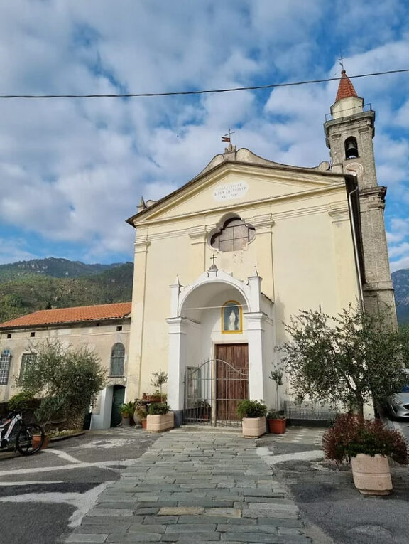
The route starts from Via Borgata Borgarino, near the former schools of Verzi, where we begin to descend towards the sea along the asphalt road that crosses the village. Shortly after the small square with the municipal playground, we turn right onto the bridge that crosses the river, passing the first of the three churches, the Chapel of the Visitation (we have already told you about it in a previous excursion) and then we head into Borgata Chiesa, passing the second church planned, the parish church of Santa Maria delle Grazie.
After passing the front square of the church, we cross a small hamlet of houses and shortly afterwards take an uphill path that will lead us to a dirt road. As we gradually enter the Mediterranean forest, we gain height and, turning southwards, the first view of the sea over the Loano plain leaves us speechless. We follow the marked road until we reach a barrier, which is easy to avoid on foot. We then continue on to the small church of San Martino di Giustenice, in the hamlet of Valsorda (the third and last church for us).
This is probably the oldest district in the municipality, which recalls the idea of a predominantly agricultural and woodland economy of the village in the past. The chapel is believed to be one of the first early Christian churches in the area (8th century); built on the ridge that divides Giustenice from Pietra Ligure, it has a Ligurian characteristic of a roof covered with “ciappe”, typical heavy slabs of crushed stone used in the past. Past the church, the path continues north-westwards where a fork in the road leads us to the meadows of Pian delle Bosse.
We fill our water bottles and admire the beautiful panorama that opens up to the coast. We pass the refuge and continue downhill towards Rocca dell’Avio. The morphology of the land reveals a part of the hinterland characterised by small rocks and sharp points. Also known as “Rocca dell’Aia”, what appears before us is a mighty quartzite tower emerging from the woods on a southern spur of Monte Carmo.
Together with the Butto rock, it is one of the most popular climbing sites in the area. Still heading south-west, it takes about 25 minutes to reach the area where the last car park has been created, the one called the Castagna. From here we continue on a steep, stony path that coincides with the final section of the Karma Trail. We cross the Fissore (then Nimbalto) torrent on a couple of occasions in the direction of the Pastunè spring and once back on the bridge we reach the finish line.
Fonte: Due zaini e un camallo.